A series on West Kootenay/Boundary place names
LADYSMITH
This place was first mentioned in the Nelson Miner of March 3, 1900: “Ladysmith is the name of a townsite recently established in the Boundary country, near Greenwood. The site has been partially surveyed, 16 blocks of 24 lots each having been laid out. The Morrison claim and several other very valuable properties surround the town, the former being partially upon the townsite. George Kydd, manager of the Nelson branch of the Bank of Halifax, has the property in charge for the owners.”
A week later, the Greenwood Weekly Times quoted the above and added: “This presumably refers to the Paul Myers ranch, which was purchased by Mr. Stewart of Nelson last fall for townsite purposes.”
The Phoenix Pioneer added: “The fever is spreading. A new town near Deadwood has been laid out called Ladysmith. There is plenty of room yet in the Boundary to plat townsites, and there are a few towns left in South Africa after which they might be named.”
The name was chosen after the Siege of Ladysmith during the Second Boer War. Ladysmith on Vancouver Island got its name the same way. There was also a Hotel Ladysmith in Greenwood.
Nothing more was heard of the town. However, we know the Morrison claim was 4.5 km northwest of Greenwood, overlooking Mother Lode creek. The mine shipped copper, silver, and gold from 1901 to 1903 and again in 1907. The workings have been poked at several times since, most recently in 2003.
LA FRANCE
La France Creek, on the East Shore of Kootenay Lake, was named for Elzear Nazaire La France (1848?-1927), who pre-empted 320 acres at the creek’s mouth on Nov. 27, 1891, although for some reason the Crown grant wasn’t issued until 1906.
Not much is known about La France himself, although it’s been suggested he was Metis. His property was first mentioned in the Nelson Tribune on Dec. 1, 1892: “Lafrance’s Landing … is a point about eight miles down the lake from Pilot Bay …”
Perry’s Mining Map of West Kootenay (1893) indicated “La France’s Place” and “Frances Creek,” along with Marysville a little to the south. However, ads suggested Maryville (without the S) was actually at the mouth of La France Creek. Either way, it appears the townsite was on La France’s property, although he wasn’t involved in its promotion.
In the massive flood of 1894, La France’s land “was completely covered with driftwood, boulders and debris … in some places to a depth of 20 feet. The cabin is located by a pole shoved through the stove-pipe hole.” On the plus side, “The gravel brought down looks as if it might carry gold.”
In fact, Thomas Wall found promising mining properties on La France Creek, which led to the incorporation of the La France Mining Co. in the early 1900s.
By then La France himself was working at a Nelson sawmill. The 1901 census indicated he was married, but his wife was not in evidence. He lived at the corner of Ward and Stanley streets. He is missing from the 1911 census, but we know he died in Kamloops, age 81.
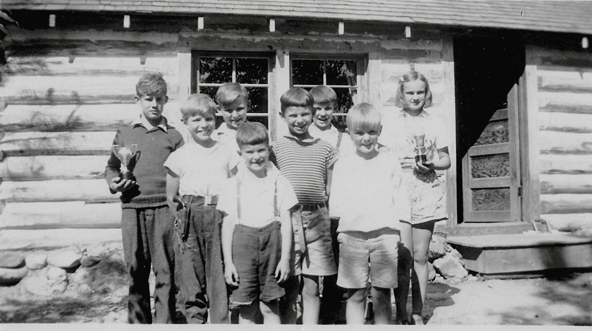
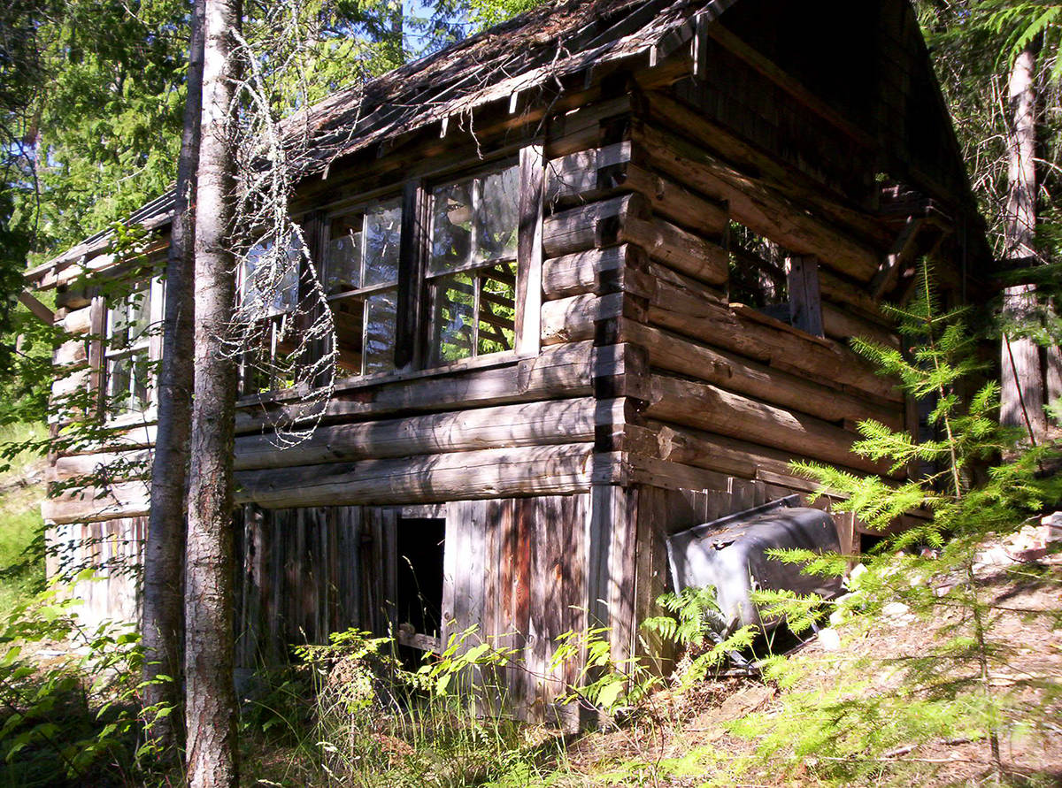
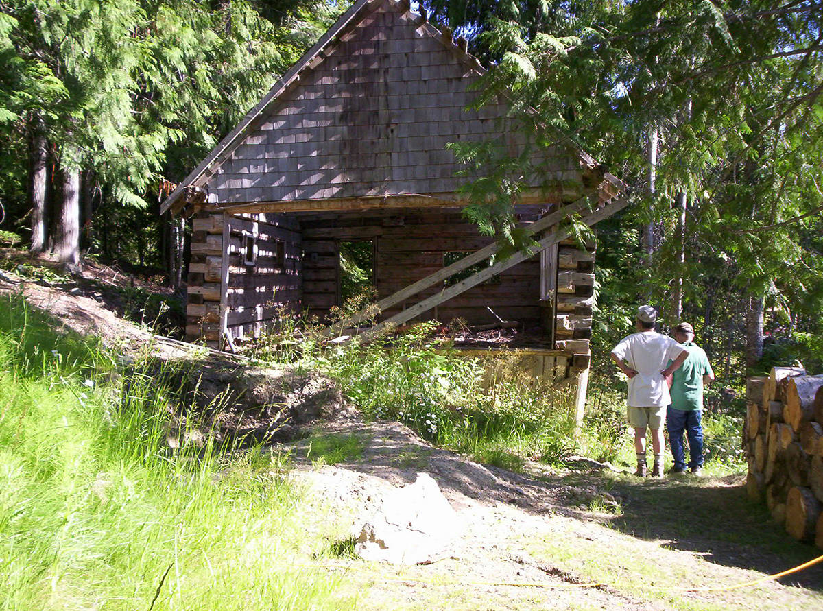
The creek name was adopted in 1903 as La France (not Lafrance) as labelled on an 1895 map. A school opened at La France in 1937 and operated for ten years. Afterward the building became the La France community clubhouse.
Today La France is better known as Mountain Shores, after the resort of the same name, founded in 1948 as Rainbow Park.
MACARONI BASIN
This colourful place name was also on the East Shore of Kootenay Lake.
The earliest reference is in the British Columbia Gazette of Sept. 24, 1896 in a legal ad about incorporating a company “to construct a railway from a point at or near the mouth of Granite Creek, thence following the creek to the summit of White Grouse Mountains; thence along and across Johns Basin and Macaroni Basin …” The railway was never built.
The name’s origin is unknown although there were Italian prospectors in the region, Pedro Cherbo and Jimmy Mannarino prominent among them. In the summer of 1897, the McLellan brothers of New Westminster opened an hotel in the basin, but nothing more was heard of it.
On Oct. 12, 1898, trapper Ernest L. Terry died in his cabin in Macaroni Basin and was buried nearby. Although the grave was marked with a cross giving his name and date of death, its exact location is now unknown.
As for the location of the basin itself, we have only the Nelson Tribune of April 11, 1899 to go on: “Macaroni basin is at the head of one of the tributaries of St. Mary’s river and not far distant from the Storm King and other mines on White Grouse mountain …”
It was last mentioned in the Tribune of Nov. 29, 1902: “Price McDonald is one of the trail builders of pioneer days who is still on the job … Price has the distinction of being the oldest inhabitant of Macaroni Basin, and for considerable periods he has had the distinction of being the Basin’s only resident.”
McDonald owned an interest in the Victoria mine for 15 years before selling it in 1906 for $7,000.