A series on West Kootenay/Boundary place names
FRITZ
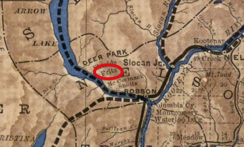
This obscure landing on the east side of Lower Arrow Lake shows up on the CPR’s 1897 map of the Kootenay, a little south of Deer Park. The name was officially adopted by the Geographic Board of Canada in 1902. However, it is no longer on the books, nor in local use. It never merited its own entry in the civic directories and its etymology is unknown.
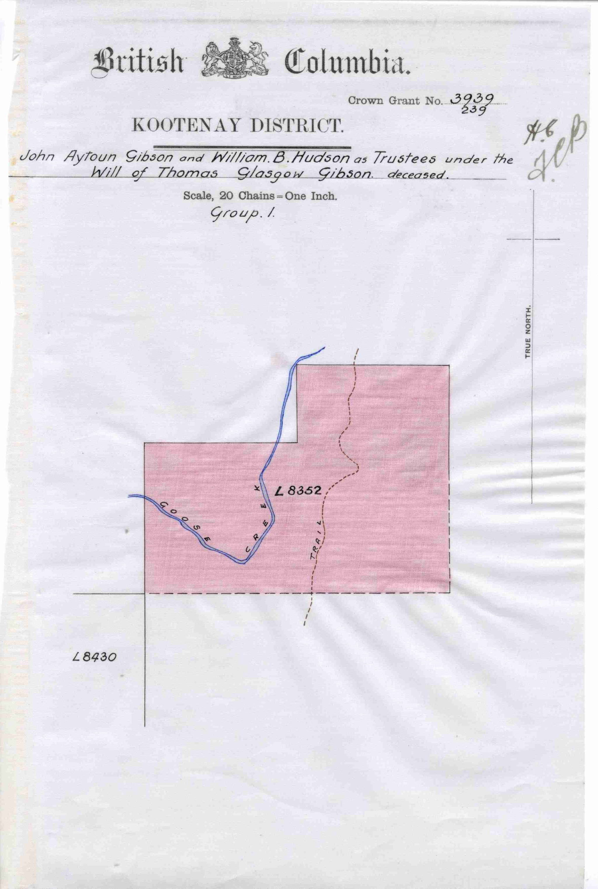
GIBSON CREEK
Gibson Creek, which flows into Pass Creek, north of Robson, is on the books officially as a community as well as a body of water, even though the name is in limited use. However, it had its own school, which opened in 1924 and was replaced in 1947. When it closed in 1966, it was the last one-room school in the Castlegar district. The building still stands as a private residence.
Gibson Creek didn’t show up in the civic directory until 1937. No residents were listed.
The creek name was officially adopted in 1951 and the community name the following year. The namesake was likely Thomas Glasgow Gibson (1865-1908), who filed a preemption for Lot 8352, through which Goose Creek flows, but died before the Crown grant was issued. It instead went to his brother, John Ayton (Jock) Gibson (Nelson’s postmaster) and William B. Hudson as trustees for the estate.
DEBORAH, GLENSIDE, GRANBY, HALE, JORDAN, KNOB HILL JUNCTION, WESTON
These were all stops on the Great Northern Railway’s branch line from Grand Forks to Phoenix, first mentioned in the Phoenix Pioneer on Feb. 18, 1905. However, an explanation was only only given for one.
“One of the stations is to be named after John Jordan, a member of the firm of Burns & Jordan, who was contractor on the new line. The correct list of stations, with their locations, is as follows: New Grand Forks yard, west of the present depot; Weston, yard at smelter; Granby, Spencer, Hale, Deborah, Glenside, Jordan, Phoenix … The junction at Phoenix, with tracks to the ore bins will be called Knob Hill Junction.”
Granby was after the Granby Consolidated, Mining, Smelting and Power Co., which owned the Grand Forks smelter and operated mines at Phoenix. It in turn was named after Granby, Que., the hometown of company co-founder S.H.C. Miner. The name was also given to the north fork of the Kettle River and to a provincial park.
Knob Hill was after one of the first mining claims staked at Phoenix by Henry White in 1891.
We’ve recently covered Spencer in this series. But the origins of Hale, Deborah, and Glenside are all mysteries. None of the names are still in use. A second Glenside appears to have existed somewhere near Bridesville. It had its own farmers institute.
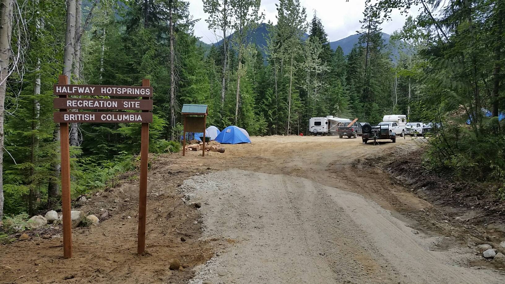
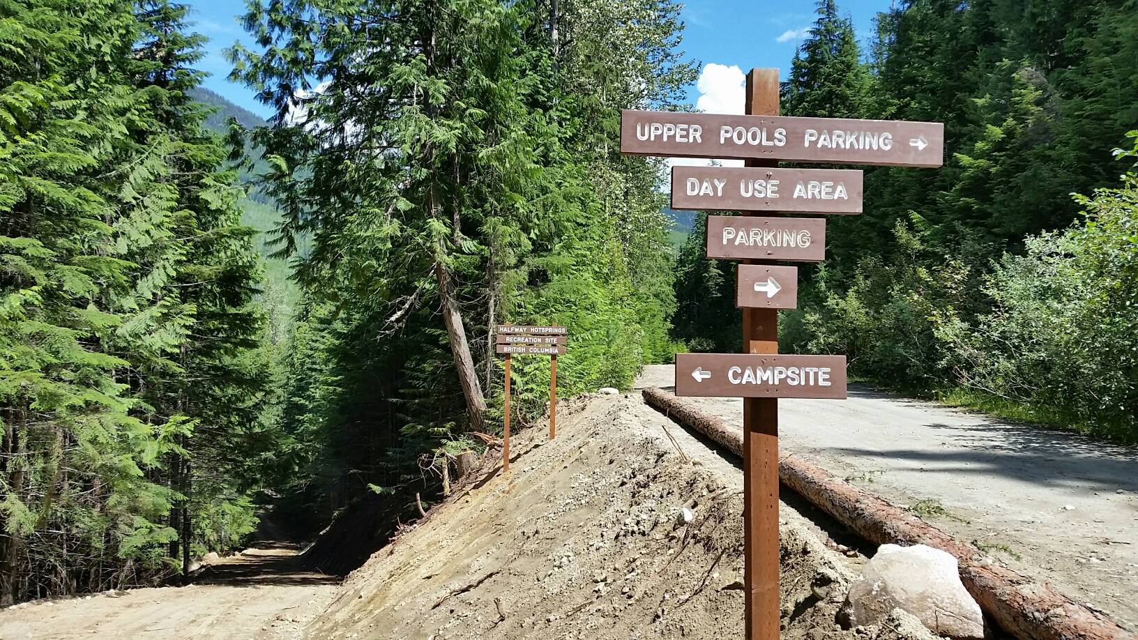
HALFWAY HOT SPRINGS
These popular backcountry springs on the east side of Upper Arrow Lake are named after the Halfway River. But what are they the midpoint between?
The recent book 100 Nature Hot Spots in BC and halfwayhotsprings.com both say they’re halfway between Revelstoke and Nakusp, but that’s not so. They’re 37 km north of Nakusp and 91 km south of Revelstoke. More likely halfway between Nakusp and Galena Bay; they’re only 43 km south of the latter.
Either way, the river name wasn’t officially adopted until 1950. The river appears on Perry’s Mining Map of 1893 and the CPR’s 1897 map of the Kootenay district, but without a name. It was first referred to as Half-way Creek in a legal ad in the Revelstoke Kootenay Mail of May 8, 1897.
The earliest mention of Halfway Hot Springs is from 1943 in a book called Interim Report of the Post-War Rehabilitation Council.
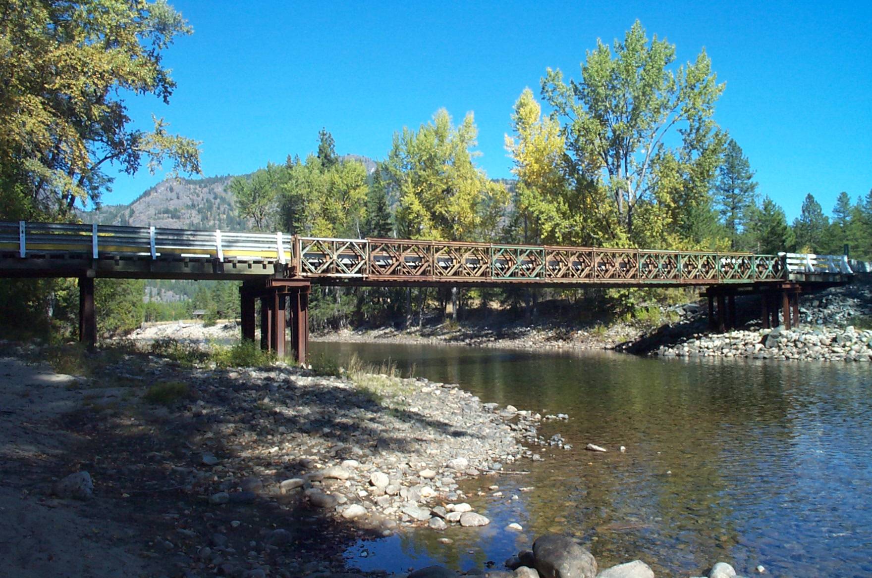
HUMMINGBIRD
This stop on the CPR’s North Fork subdivision, north of Grand Forks, was named after a local mine. It was first mentioned in the Phoenix Pioneer of Feb. 16, 1901: “The Humming Bird siding, at Lime creek, on the north fork of Kettle river, is completed and shipments have been started.”
Ore from the Rock Candy mine, now a tourist attraction, was originally piled at this siding.
It was listed in the 1918 civic directory as “a flag station on [Kettle Valley Railway], Carson and Lynch Creek branch, 75 miles from Lynch Creek, 11 miles from Grand Forks … Local resources: Mining, tie cutting and logging. No permanent residents, the loggers and miners being transient.”
It was last listed in 1936, but the name survives in Hummingbird bridge, which crosses the Granby River.