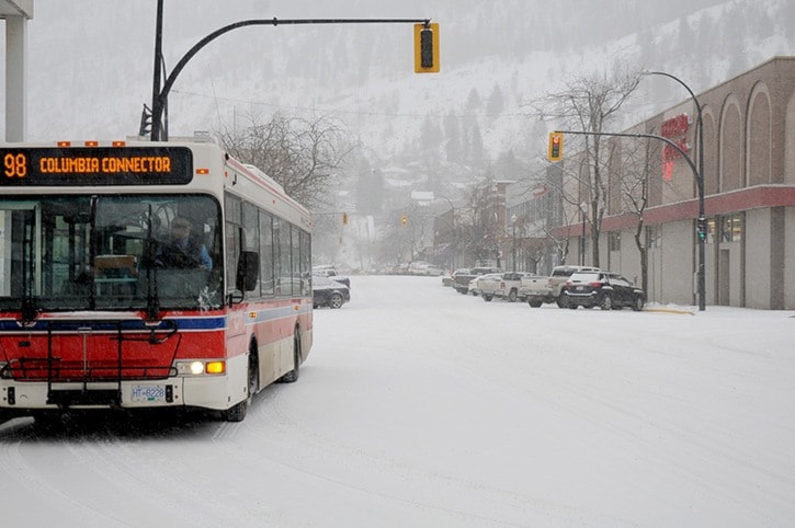
Students from kindergarten to college were given a snow day on Monday after the region was blanketed in heavy snowfall over the weekend.
Flakes began to fall on Friday and within 72 hours, 33 centimetres had accumulated, jamming up roadways and closing sections of highway throughout the Kootenays as well as the Kootenay Pass.
Jesse Ellis from the Castlegar weather offices, says the Tuesday and Wednesday forecast currently show a bit of a reprieve with a drier and westerly flow between storm systems.
However, Ellis warns that before sunrise Thursday the region will likely be digging itself out again, with precipitation expected to be a mix of freezing rain, rain and snow.
The climate trend this second week of February mirrors the unusually high snow piles in the first month of the year.
That’s because January was cold, cold, cold.
Three new daily lows were set, and the month was three degrees colder than usual.
At the centre of the extended icy snap was a system that originated from the far north, reports Ron Lakeman from the Castlegar weather offices.
“A relatively dry upper flow and a modified Arctic air mass at the surface dominated the majority of the month, resulting in cooler and drier than average conditions,” he notes in his month-end summary from the Southeast Fire Centre.
(A modified Arctic air mass refers to an air mass from the Arctic that takes on characteristics of new surroundings as it travels south, and gradually becomes warmer and less dry).
The coldest day, - 20.4 C, was recorded the morning of Jan. 3. That temperature broke a seven-year record for the day but did not shatter the record low of - 25.4 degrees, set on Jan. 1, 1979.
Lakeman notes two daily minimum temperature records were also broken during the early morning hours of Jan. 7 (-18.2 C) and -18.9 C on Jan. 13.
Overall, the mean monthly temperature was 3.1 degrees cooler than average. And it’s those cold temperatures that allowed the snow to stay (mostly in the valley), because, in fact, the total snowfall was only 72 per cent of normal.
However, despite the lower than average precipitation, the month-end snowpack stacked up to 35 centimetres (cm), which is the greatest month-end value for January since 2008.
The majority, 90 per cent, of the month’s precipitation fell during two storms, Lakeman said.
Over 24 hours beginning Jan. 7, 11.4 cm of snow was recorded. Ten days later another 26 cm of snow fell on Jan. 17, which turned to 11.2 cm of rain the following day.
“The total amount of precipitation during the month was 69 per cent of normal,” he added.
The most common wind direction was northerly, with gusts of over 30 km/hr on six separate days.