Two-hundred ninety-third in a series on West Kootenay/Boundary place names
We’ll take a break this week from studying neighbourhood names to revisit some places we’ve already covered in this series, for whom earlier first mentions have been found.
You might well ask what difference it makes whether a name was used three days, three months, or three years sooner than previously thought. The answer is that while it is partly a parlour game, the earliest references can sometimes reveal who chose the name and why.
CRAWFORD BAY, REVISITED
Previously the first known reference to Crawford Bay on Kootenay Lake was from 1890. But we now know the name was in use at least a couple of years earlier.
The Spokane Falls Review of Sept. 21, 1888 reprinted this item from the Butte Miner: “On the east side of the lake, north of Crawford’s bay, which is directly opposite the outlet, the ore is silver in a galena formation and the Blue Bell is the principal mine here.”
Crawford Bay and Crawford Creek were both named after prospector/trapper James Crawford (1860-1914).
NELWAY, REVISITED AGAIN
The earliest use of Nelway has been pushed further back. While the border crossing south of Salmo opened on Aug. 29, 1923, its present name (a contraction of Nelson and Spokane Highway) didn’t show up for a while. Previously the earliest example was from April 1926.
But the Spokane Chronicle of Aug. 6, 1925 said “Note – Canadian customs office now located at Nelway just north of boundary, instead of at Salmo.”
It’s hard to fathom today, but in many places, you used to drive well into Canada or the US before encountering customs officials.
REMAC, REVISITED
The Spokane Spokesman Review of June 4, 1950 explained the difficulty of choosing a post office name for the community that grew up around the Reeves-MacDonald lead mine near Nelway.
The mine was named for prospectors Robert Mills (Robbie) Reeves (1869-1931) and John Hugh (Black Jack) MacDonald (1864-1942). But there were already post offices called Reeve and MacDonald, both in Manitoba.
Pend d’Oreille was suggested, after the river the mine was situated on. But there was already a Pendant d’Oreille post office in Alberta.
Next suggestion was Falls City, a failed townsite in the area. But there was already a Falls City, Wash. Then came Dewdney, since the Dewdney Trail passed through the area. Also taken.
Next, Haynes, after John Carmichael Haynes, who as BC’s gold commissioner drew attention to the future Reeves-MacDonald mine in the 1860s. Too similar to Haines, Alaska.
Joe Streit, the mine’s chief accountant and postmaster finally concluded: “What was there left but Remac?”
When the Remac post office opened on Feb. 8, 1950, it was one of the first to use Roman numerals for the months in its cancels.
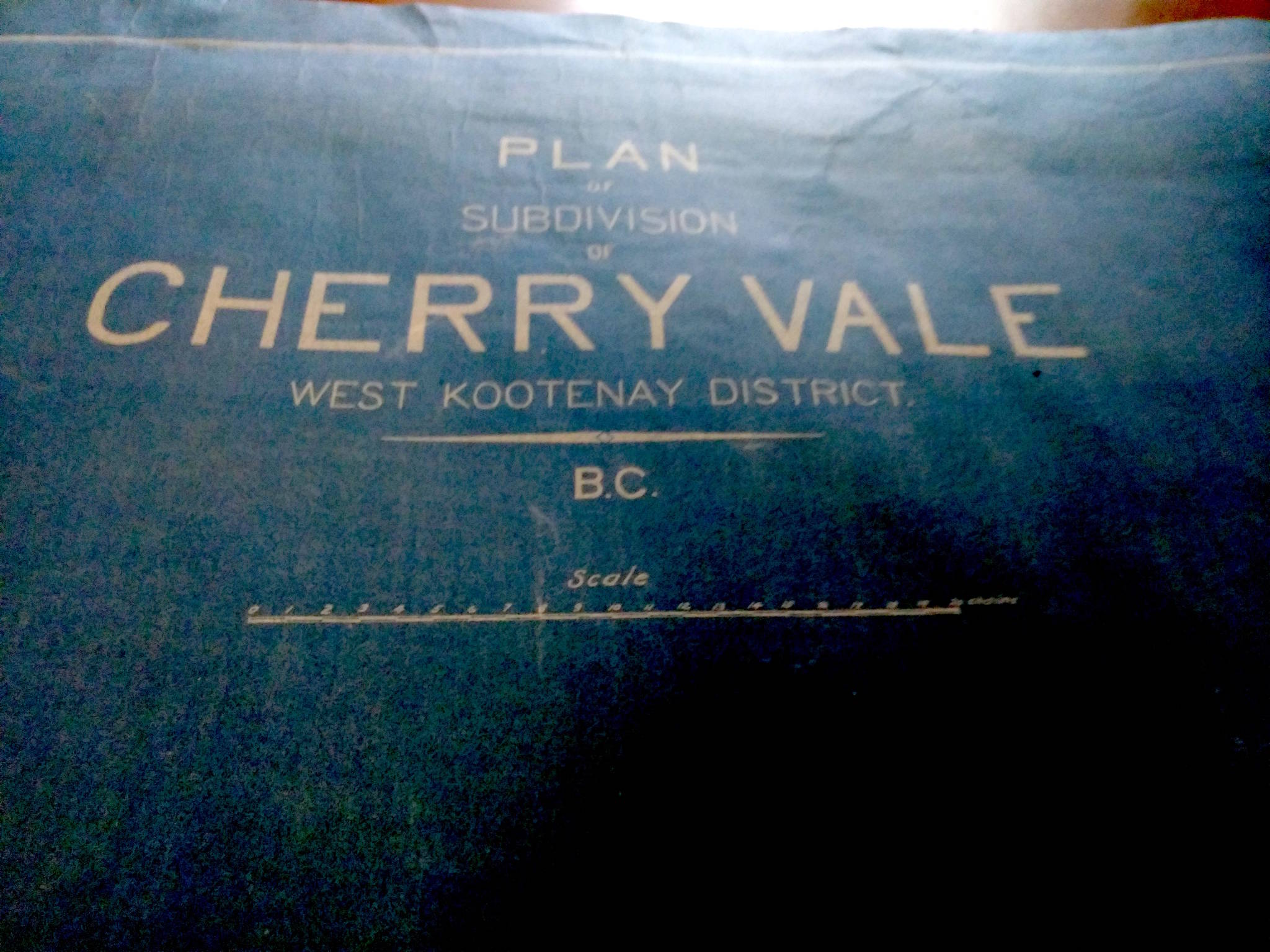
CHERRYDALE (OR CHERRY VALE), REVISITED
We’ve looked previously at Cherrydale, developed in 1908 as a fruit growing area north of Slocan Lake.
An undated map of this subdivision recently turned up in the Silvery Slocan Historical Society collection, but it bears the name Cherry Vale. Which is correct? It’s not clear, although either way, cherries failed to flourish there.
The area would now be considered part of Hills.
PHOENIX, REVISITED
We’ve seen how the Boundary ghost town of Phoenix was originally called Greenwood Camp.
But while previously the earliest mention was from early 1894, we now know the name was around by Dec. 3, 1891, when the Spokane Chronicle reported: “In the Greenwood camp is the Brooklyn mine, owned by Joe Taylor and partners …”
Phoenix was nearly called Brooklyn when it came time to open a post office in 1898. But that was already the name of a Lower Arrow Lake boomtown, so residents opted to go with Phoenix instead, after another leading mining property.
QUIRK SIDING, REVISITED
Our look at Quirk Siding, a railway stop 3.7 km north of Waneta, noted the name dated to BC Hydro’s construction of the Seven Mile Dam in the 1970s. Roger Burrows in Railway Mileposts, Vol. II suspected it might have honored an early resident.
But Rossland’s Larry Doell provided a much more likely explanation: Edward T. Quirk was BC Hydro’s project manager on the dam. Quirk was born in Cranbrook and grew up in Kimberley. He earned an engineering degree from UBC and joined the BC Power Commission in 1954. He was also construction manager on the Duncan Dam and Kootenay Canal. If still alive, he’d be about 95.
Quirk Siding isn’t an official name, but it is home to a reload centre mentioned in the news last year following an acid spill.