A series on West Kootenay/Boundary place names
West Kootenay’s three mountain ranges — the Monashees, Selkirks, and Purcells — combined with the Cariboos make up the Columbia Mountains.
First to be named were the Selkirks, which extend from the Big Bend of the Columbia River in the north to Lake Revelstoke and the Arrow Lakes in the west, to Kinbasket Lake, Kootenay Lake, and the Duncan River in the east, and drop into Montana in the south.
According to G.P.V. and Helen Akrigg’s British Columbia Place Names, explorer David Thompson dubbed them Nelson’s Mountains, after Admiral Horatio Nelson (the name survives in the Nelson Range — but not in the City of Nelson, which was named for Lt.-Gov. Hugh Nelson).
After the North West Company and Hudson’s Bay Company merged in 1821, the mountains were renamed after Thomas Douglas (1771-1820), the 5th Earl of Selkirk and a part owner of the HBC.
However, finding examples prior to the mid-1860s is difficult. The earliest we can locate is from the Victoria Daily Colonist of Aug. 14, 1865, in which one W.S. Stone wrote: “I am informed by an Indian that a band of 30 or 40 horses were driven over by Indians from Kootenay, across the Selkirk range, and I saw their tracts and manure on the top of the Gold range.”
The name was not officially approved until 1930. It was altered in 1959 to exclude the Purcell Mountains (which we will get to momentarily).
Other related names include two Selkirk Creeks — one of which flows into the Incomappleux River, the other into Cranberry Lake — and Selkirk Peak, southwest of Sandon. The mountains also gave Selkirk College its name, suggested in 1966 by the late librarian John Mansbridge to replace the provisional name of West Kootenay Regional College.
Next to be named were the Purcells, which stretch from Montana to the south end of Kinbasket Lake, between the Rocky Mountain Trench and Kootenay Lake.
They were dubbed by explorer Dr. James Hector after Goodwin Purcell (1817-76), a professor of therapeutics and medical jurisprudence at Queens University, Cork. According to J. Monroe Thorington’s 1946 book The Purcell Range of British Columbia, Hector and Purcell sat together on the committee that chose personnel for the Palliser Expedition.
Purcell’s Range appeared on a Palliser map dated 1859 and a conflicting account has Capt. John Palliser choosing the name himself. It also appears on 1863 and 1871 maps, but the name didn’t seem very popular until well into the 1900s.
Purcell Range was formally adopted in 1918 by the Geographic Board of Canada, but the form was changed to Purcell Mountains in 1954. When mining engineer Michael E. Purcell died in 1925, his obituary in the Nelson Daily News falsely claimed he was the mountains’ namesake.
Geographic features named Purcell are sprinkled throughout BC, but the other key one in our region is the Purcell Wilderness Conservancy, established in 1974.
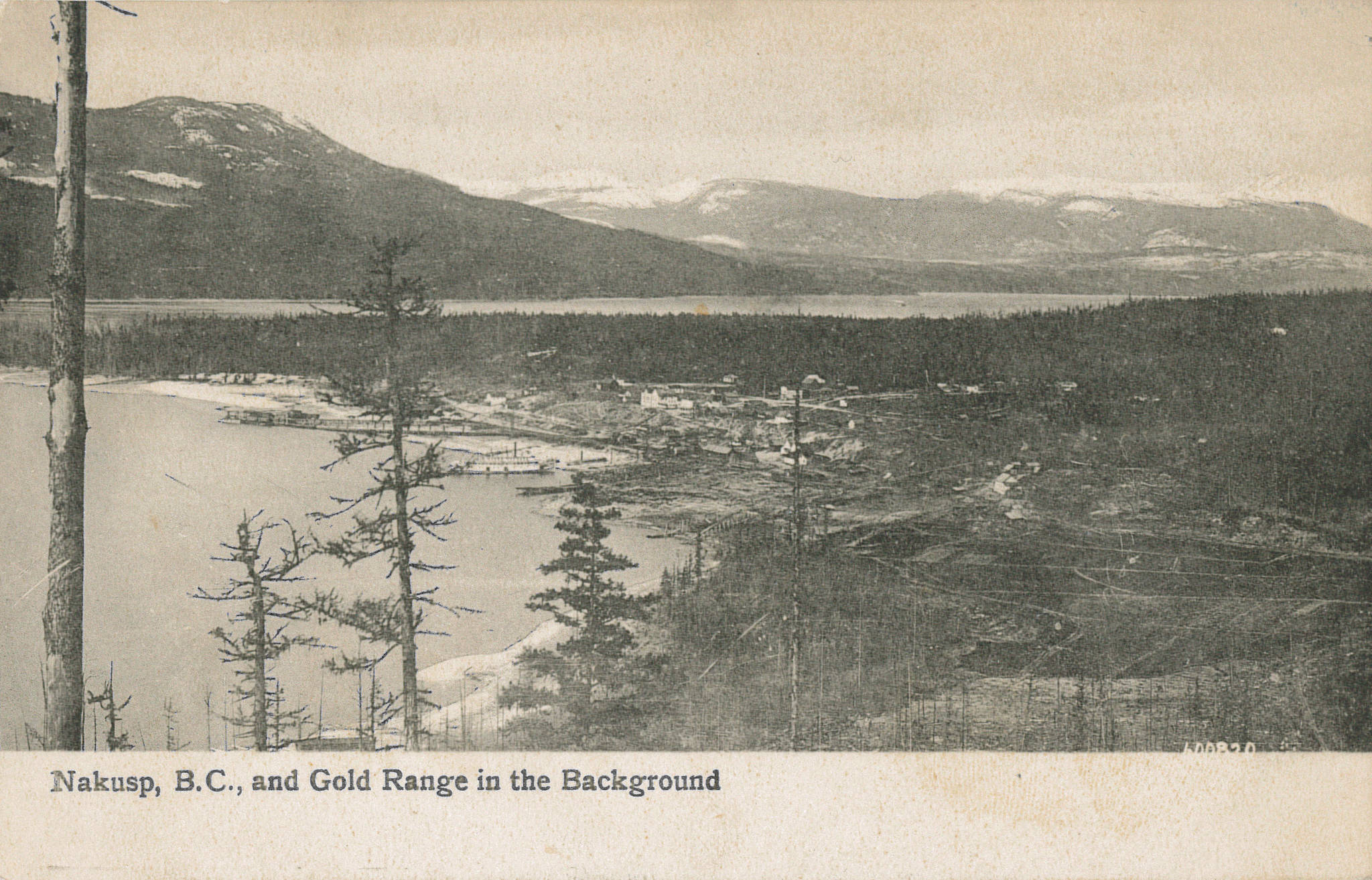
That brings us to the Monashees, which extend north from Washington state on the west side of the Arrow Lakes, Columbia River, and Kinbasket Lake. They were formerly known as the Gold Range, a name reportedly chosen by George Dawson in 1877 — but it already appeared on Joseph Trutch’s 1871 map of BC and in the 1865 Colonist quote cited above.
The Gold Range is now limited to a strip along the west shore of the Arrow Lakes and Columbia River, from Revelstoke down to South Fosthall Creek and Sitkum Creek on the south, and over to the Shuswap River on the west.
Monashee originated with the Monashee mine on Monashee Mountain, southeast of Vernon, reportedly staked around 1881 by Donald McIntyre (1831-1917). The word is from the Gaelic monadh, meaning mountain, and sith, pronouced shee, meaning peace. So, mountain of peace.
A romantic story accompanies McIntyre’s selection of the name — apparently he was inspired when the weather on the mountaintop suddenly cleared following a miserable day of prospecting.
The earliest known mention of the mine is in the Victoria Daily Times, Feb. 15, 1887: “Mr. W. Dewdney reports a revival on Cherry creek, prospecting on Kettle river and favorable returns from Monashee quartz ledge.”
The mountain is first mentioned in the 1887 Minister of Mines report, regarding two men who recorded a claim and returned “to cut out 16 miles of a trail from the Monashee mountain …”
In 1918, the name was officially expanded to apply to all mountains from the Arrow Lakes and Columbia River west to the Okanagan and Spallumcheen Rivers and Shuswap Lake, and from the US border north to the Canoe River. (However, as of 1963, the mountains of the Shuswap and Quesnel Highlands were included in the Interior Plateau rather than the Monashees.)
The name further proliferated in Monashee Creek, which flows into Cherry Creek, east of Echo Lake; Monashee Park, between Upper Arrow Lake and Sugar Lake, south of Revelstoke; the Monashee Pass, on Highway 6, between Lumby and Edgewood; and Monashee Pass Creek, which flows into Monashee Creek. The 1915 Minister of Mines report also mentioned a “Monashee townsite” at the eponymous mine, but it didn’t amount to much.