A series on West Kootenay/Boundary place names
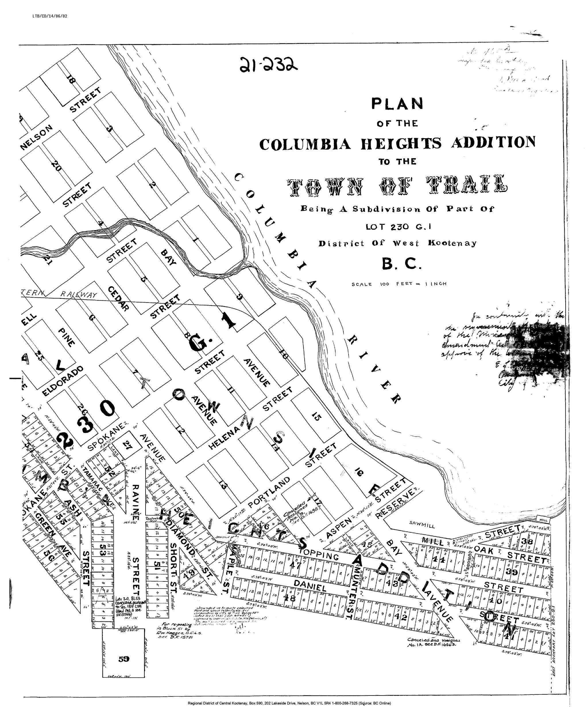
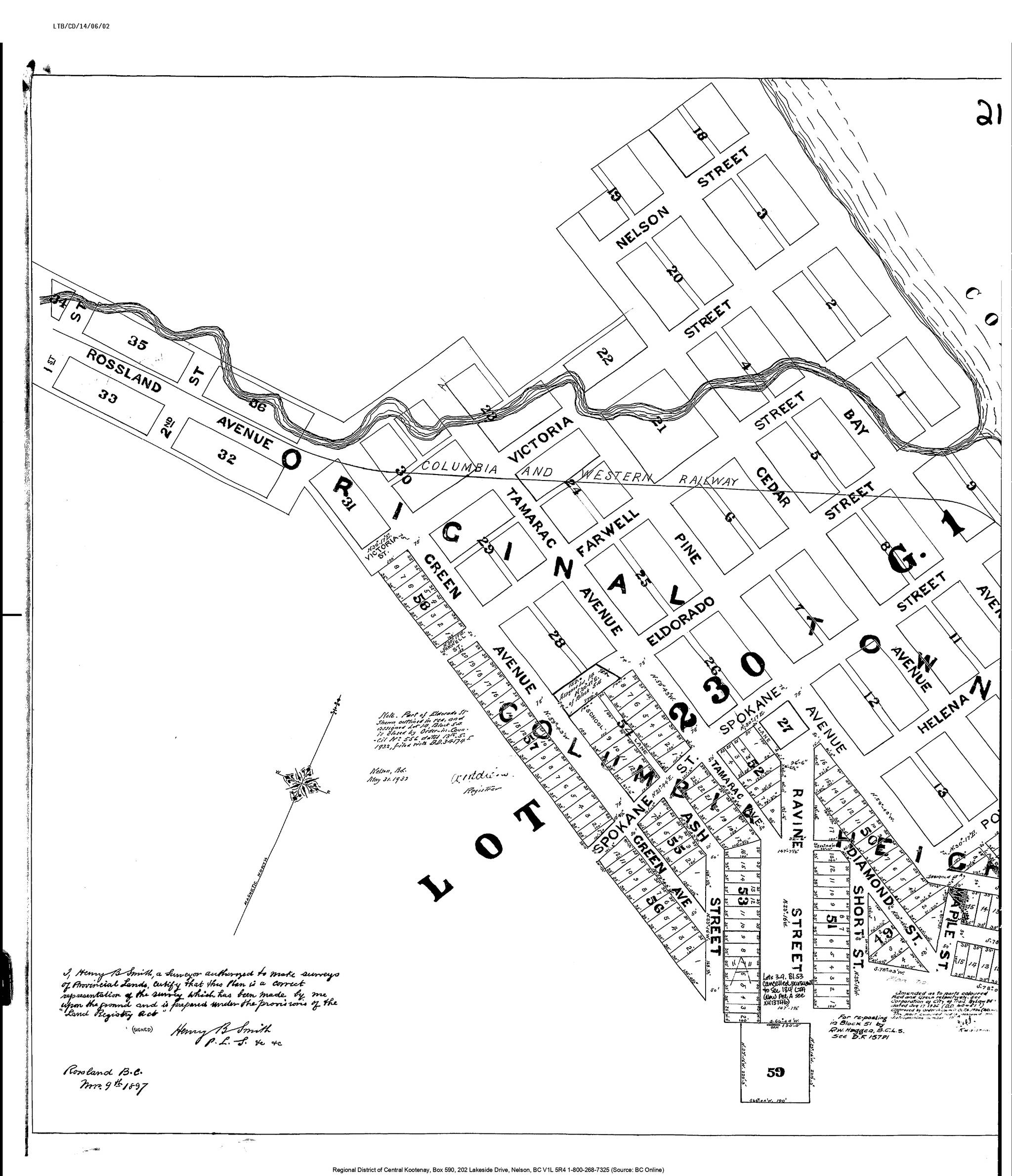
Trail has at least nine distinct residential neighbourhoods, plus a few bedroom communities outside city limits. One of the oldest is West Trail, also known as Columbia Heights. Richard T. Daniel and Eugene Topping teamed up to buy benchlands on Lookout Mountain in 1896 and the following year hired Henry B. Smith to lay out lots and streets, which included Green Avenue plus Ash, Ravine, Short, Diamond, Maple, Topping, Daniel, Oak, and Mill streets (the latter is now part of Riverside Avenue).
Topping also owned mines on Lookout Mountain, whose failure forced him to give up many lots for unpaid taxes. An ad for the real estate firm of McQuarrie and Robertson in Opportunities magazine in August 1912 stated: “[O]wing to one of the owners getting into liquidation the property was tied up and not offered for sale. We have now straightened out the title.”
The name Columbia Heights was used regularly through the 1910s, but for some reason faded by the mid-1920s, replaced with West Trail. But it made a comeback starting in the mid-2000s, popping up in real estate ads, when Trail’s cheap house prices began to make national headlines.
When Chris Moorhead ran for city council in 2002, he declared he lived in Columbia Heights, which he felt had a “different connotation” than West Trail. Once elected, he and fellow councillor Gord DeRosa championed a resolution to officially rename the area from Daniel and Topping streets through to Reservoir Road as Columbia Heights.
But the late Ken Dimock was puzzled. “I was born and raised on Topping Street and as far as I am concerned it is still Columbia Heights,” he wrote in a letter to the Trail Times. “West Trail was and still is the Gulch. The Lookout area may have been referred to as Central because everyone on the west side of the river went to Central school.
“Was Columbia Heights ever changed? I don’t think so. My feeling is that the name was dropped when new realtors came to town and figured everything on the east side of the river was East Trail, therefore everything on the west side must be West Trail. Well, not so. Our family was gone from Topping Street about 1964 and at that time it was still Columbia Heights.”
Today’s Tourism Trail map shows Columbia Heights as to the east of Rossland Avenue and West Trail to the west, although the exact dividing line is not clear. Curiously, the map doesn’t show the Gulch at all. Google Maps shows West Trail, but no Columbia Heights or Gulch.
Is West Trail really synonymous with the Gulch, as Dimock had it? Or is the Gulch part of West Trail? Or are they completely separate?
And is the Gulch merely Rossland Avenue or more than that? It certainly includes Bell Place, 2nd Street, Railway Lane, and Old Rossland Avenue. It used to include Byers Lane and 1st St. (obliterated to create a truck chain-up area) and the former Ceccanti Street, close to where the bocce pits are.
It probably includes Lerose Street, White Street, Perdue Street, and at least portions of Binns St. and Glover Road. But does it go further up the hillside to Esling, Kitchener, Coleman, Buckna, Martin, and Hendry streets and Austad Lane? Or is this part of Columbia Heights/West Trail?
Part of this area was formerly known as Glover’s Bench, after Frank Glover (1884-1966), who built a road up the side of the hill. The Glovers had a dairy farm and orchard on Lot 6066, for which Frank obtained a Crown grant on Nov. 10, 1904. The family home was at 404 Austad Lane.
We’ve previously looked in this series at the Gulch, which started out in 1896 as Dublin Gulch, a name imported from the former smelter town of Butte, Montana. After 1902, the Dublin was dropped and it was just the Gulch — which made some sense, since the Gulch was predominantly an Italian neighbourhood, not Irish.
The earliest example without the Dublin is in the Vancouver Daily World of May 14, 1901: “The people who live in the ‘gulch’ property do not feel justified in making substantial improvements, as the question of title is still in abeyance … There has never been a proper survey made of this property.”
The following year, surveyor J.D. Anderson solved that problem.
We’ll look at more Trail neighbourhood names next week.