A series on West Kootenay/Boundary place names
Last week we started looking at Trail’s neighbourhoods, including Columbia Heights, which became West Trail before reverting to its original name.
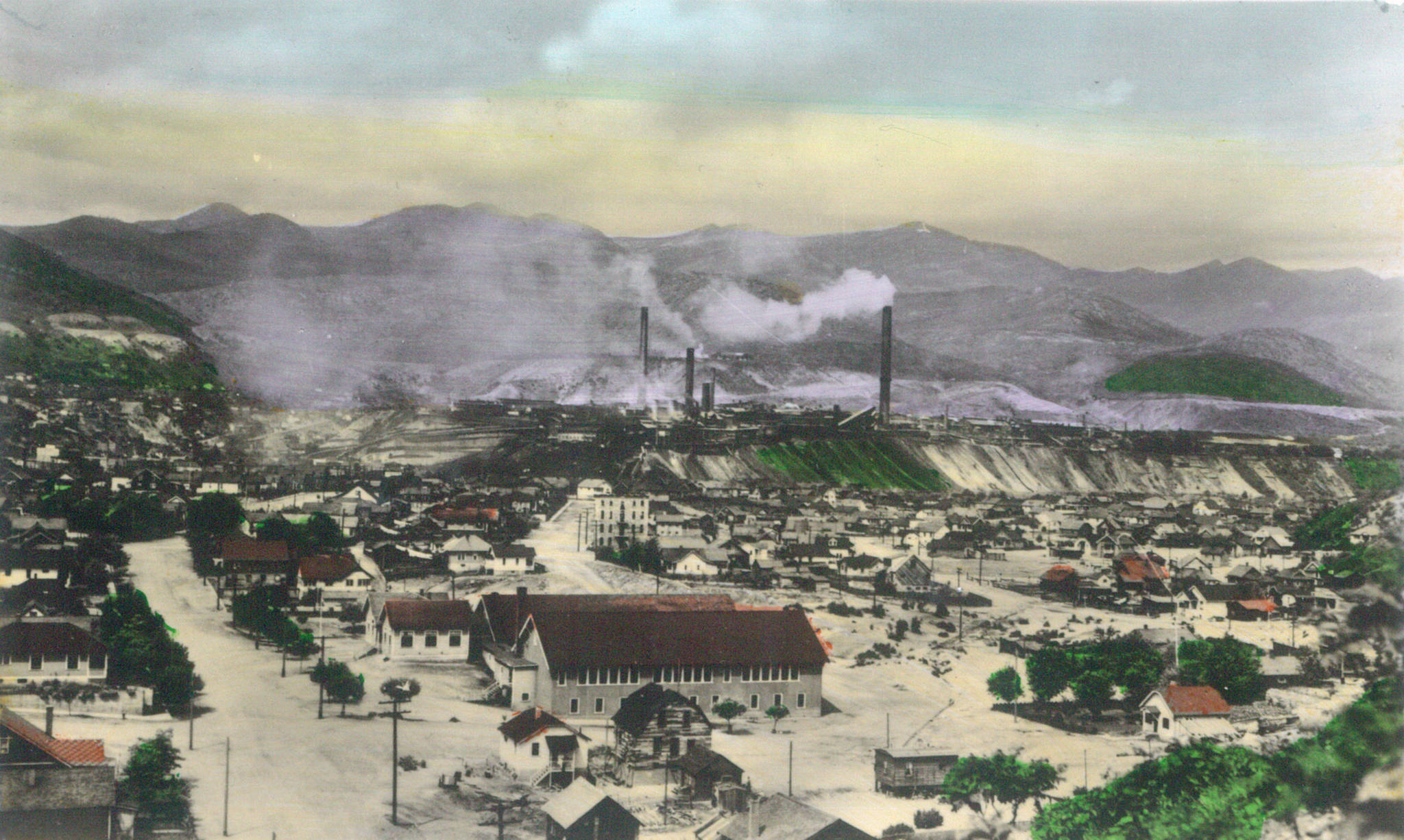
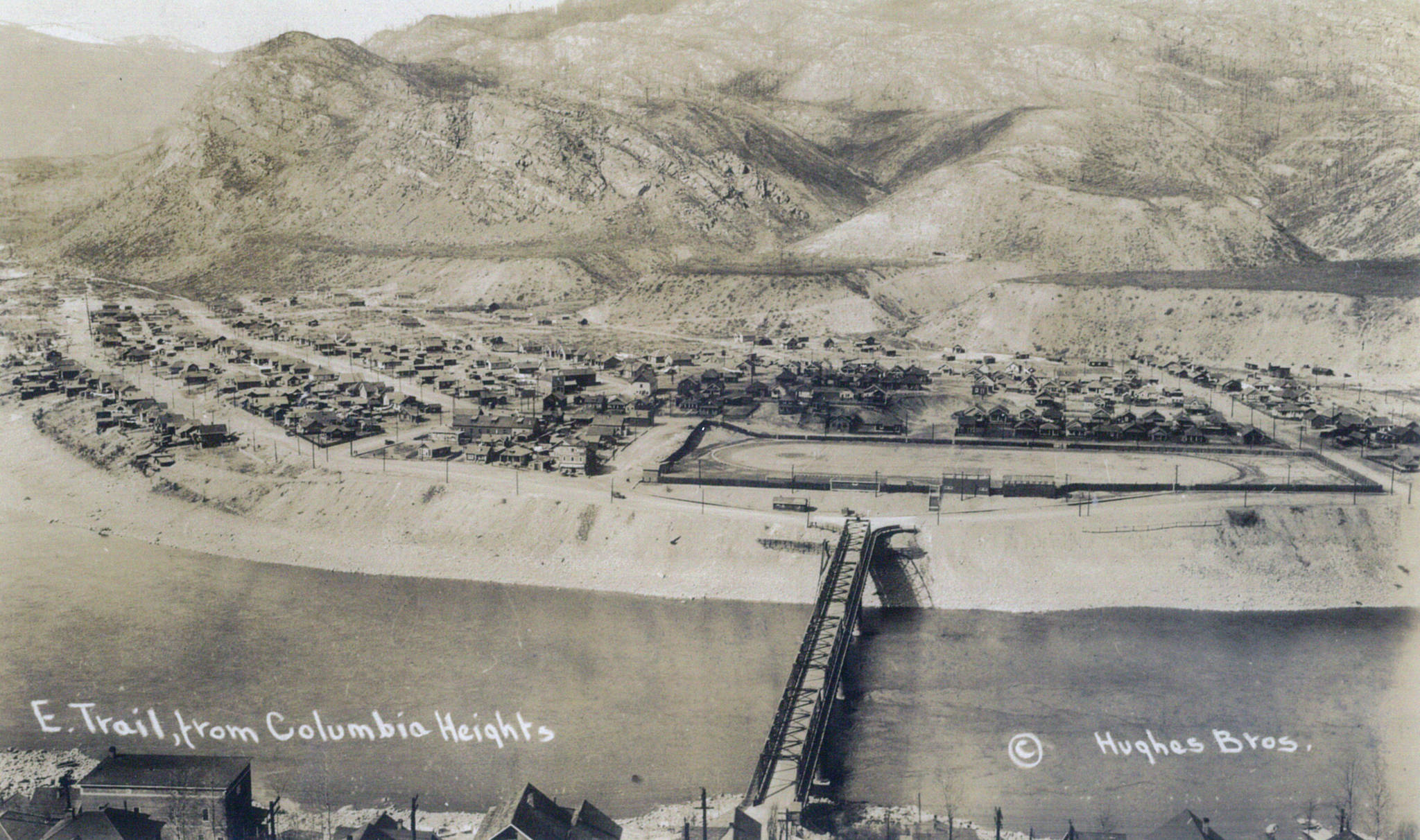
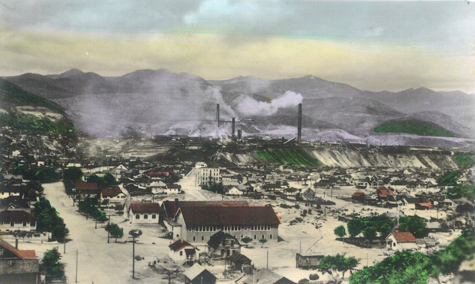
East Trail, on the northeast side of the Columbia River, didn’t become a major residential area until the old bridge opened in 1912, although prior to that a ferry connected the two sides.
The Greenwood Ledge of Nov. 25, 1915 reported: “Across the river from Trail there is a town called East Trail. About 80 families live there, and a general store has been recently opened by C. Hicks.”
According to A Guide to Historic Buildings and Places in Trail, realtors Mungo McQuarrie and Hugh Robertson bought land in East Trail from T.W. Bingay in 1916 and had it subdivided, naming streets after themselves. (McQuarrie also has a creek named after him in East Trail as well as a street in Nelson, where he was mayor in 1918.)
The other streets in East Trail are Park, Main, McLean, McBeth, Thom, Clark, Circle, Noran, Gardner, Taylor, Goepel, and Stewart, plus Columbia, Second, Third, Fourth, and Fifth Avenues. The area around McLean, McBeth, Gardner, and Stewart streets, south of the old bridge, was known as Little Scotland for its sizable number of Scottish immigrants.
Oddly, Main Street was never East Trail’s major commercial thoroughfare, a title that originally belonged to Columbia Avenue, and shifted to Second Avenue when the present Highway 3B was built in 1965. The latter bisected East Trail through what was formerly Bailey Street, a name that still survives on a few addresses and appears on some maps.
East Trail joined city limits in 1925.
Above and northeast of East Trail is Shavers Bench, named for John Samuel Shaver (1872-1955) of Rock Creek, who bought the land in the mid-1920s and created the East Trail Waterworks Company.
The name was originally Shaver Bench, as in this example from the Vancouver Province of Aug. 5, 1933: “Two sites have been suggested [for a new athletic park], and while that on Shaver Bench would be cheaper, a park at Sandy Island would be much more popular …”
An apostrophe and S were added by the time the Shaver’s Bench Improvement Association incorporated in 1940. Today Google Maps omits the apostrophe, but the Tourism Trail map retains it.
Five Shavers Bench streets are named for former BC premiers: Oliver, Brewster, Bowser, McBride, and Tolmie. In addition, there’s Rockland Avenue, Valleyview and Randall Drives, East Street, and Sixth through Tenth streets.
Follow McBride Street up the hill and you reach Miral Heights, a neighbourhood built on land that Thomas McKelvey and Joseph Randall purchased in 1915. John Shaver acquired the property in 1926 and built a reservoir and wooden pipeline to serve Shavers Bench. Later the Beetstra family ran a dairy there.
The present subdivision was established in 1979 by Albert Kryski (1920-89) and named by combining his name with his wife Miriam’s (1925-2017). Miral Heights’ streets include Albert Drive, Patrick Drive, and Colin Crescent — named for three of the Kryskis’ sons.
To the east of Shavers Bench and Miral Heights is Glenmerry, originally known as Merry’s Flats after George Legge Merry (1851-1937), who came to Rossland as a carpenter in the 1890s and acquired property at Annable and west of Castlegar, where Merry Creek was named for him.
The earliest known mention of Merry’s Flats is actually in connection with a ski jump there. The Vancouver Province of Feb. 7, 1932 noted: “Nels Nelsen of Revelstoke … made 160 feet in the first exhibition and 163 in the second on a new hill on Merry’s Flats.”
Merry’s Flats was otherwise used for farming, haying, and dairying — it was home to the Glenone Dairy, owned by Sam Barkley from Glenone, Ireland. In 1950, a subdivision was proposed for Merry’s Flats under a federal-provincial-municipal housing scheme. Following a referendum that year, both Merry’s Flats and Shavers Bench were added to city limits.
The city then held a contest to name the Merry’s Flats subdivision. The winner, chosen from among 631 entries, was announced on April 15, 1952: W.D. Love of Fruitvale and LaVonne Wallace of Trail each suggested Glenmerry, combining Glenone Dairy plus Merry’s Flats. It also recalled G.L. Merry’s initials.
Glenmerry’s streets were chosen by contest as well, and named after flowers and trees: Lilac, Dahlia, Tulip, Lily, Aster, Marigold, Heather, Primrose, Dogwood, Rosewood, Cottonwood, Carnation, Laurel, Woodland, Glenwood, and Laburnum. Highway Drive cuts through the south end of Glenmerry and connects to East Trail.
We’ll round out Trail’s neighbourhoods with a look at Sunningdale, Waneta Junction, and a few others in a later installment.