Add another foot to the high water level of the Columbia River.
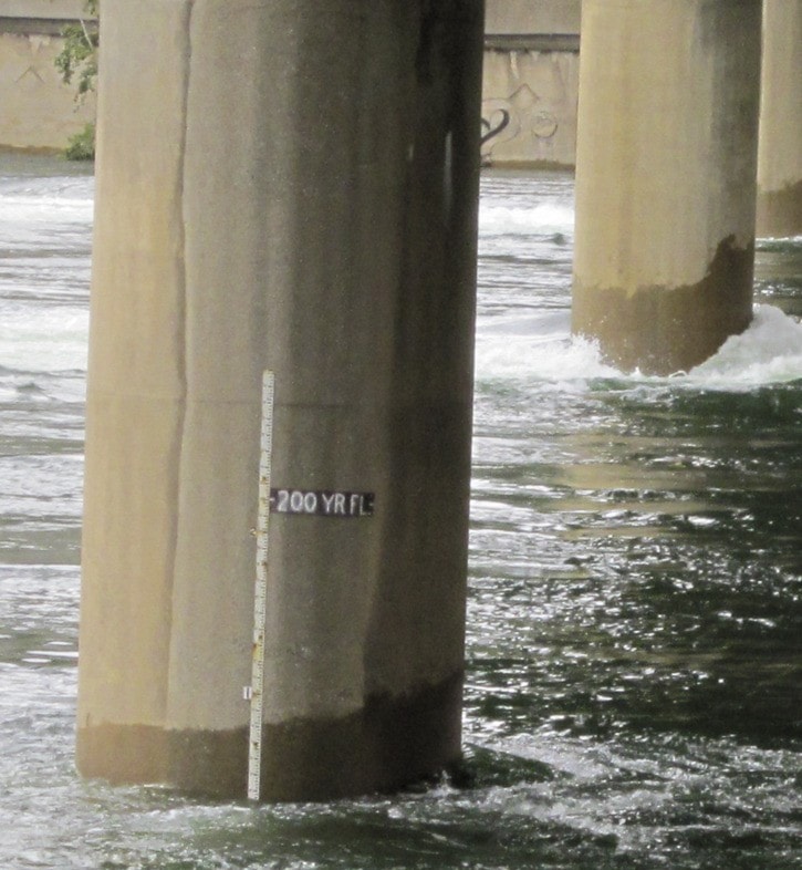
With the mighty waterway already flowing at a near record rate, BC Hydro noted that flows increased by one foot over the weekend, with flows cresting at 225,000 cubic feet per second on Sunday.
A Columbia River update Monday, however, noted the river level is coming down. For now.
“(The river) is diminishing gradually as Kootenay River flows drop,” read the report for Monday.
“It may increase in future but likely not beyond peak flows seen to date.”
Tributaries in the central and northern part of the Columbia River basin showed significant response to rainfall on the weekend but are now receding, said BC Hydro’s stakeholder engagement advisor Jennifer Walker-Larsen in the report.
She said the weather forecast called for significant rainfall in the northern part of the basin again early this week and then, hopefully, a respite from the rain.
“Depending on inflows around the Columbia-Kootenay system, high reservoir levels and Columbia River flows may continue until late July or early August,” she said.
And that could spell trouble in Trail. According to the City of Trail, the river level means some properties in the downtown core will take on water in their basements through basement floor drains or other seepage due to the high water table.
“Property owners in the downtown should take action to remove any valuable materials or items stored in their basements,” stated a warning on the city’s website.
The city noted it was continuing to monitor key infrastructure in the community.
Residents should exercise extreme caution in and around the shoreline of the Columbia River.
On Saturday, a man fell into the swift river waters, but Kootenay Boundary Regional Fire Rescue members managed to pull him out before he passed the Old Trail Bridge.
The Columbia River flow at Birchbank (BIR) is currently 209 cubic feet per second (KCFS) and receding gradually from its peak of 215 kcfs.
Currently the Columbia River flows at Birchbank are the highest flows recorded to date since the construction of the Columbia River Treaty storage dams. This flow, however, is still well below the pre-dam peak level of 374 kcfs in 1961.
But the Greater Trail region’s emergency operations centre was activated Thursday afternoon to deal with the rising levels of the Columbia River. The move was predicated after BC Hydro announced that, due to heavy rainfall events above the Mica Dam, increased amounts of water needed to be released into the Columbia River.
The duration for the increased release was expected to end later this week, dependent on weather and rain fall, said Alan Stanley, director of environmental services for the Regional District of Kootenay Boundary.
For further information, contact Stanley, RDKB public information officer, at 250-368-1648.
Further updates on the river’s rise will be posted on the City of Trail website www.trail.ca.