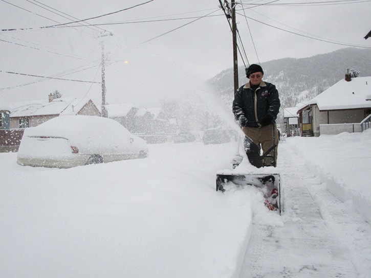
It's going to be a mess out there this week once the rising temperatures roll in following the heaviest snow dump of the season.
A warm dry climate is expected to return by Wednesday, following a mid-latitude or frontal cyclone that covered the Greater Trail area with about 34 centimetres (cm) of snow between Sunday afternoon and early the following morning.
Local weatherman Jesse Ellis says the precipitation trend will move in the northeastern direction by today and for the most part, the rest of the week will be dry with unseasonably warm temperatures.
“By Tuesday a lot of big weather will have happened,” he said. “Anything later is low confidence. But Wednesday does show we are going into a warm southerly flow with above seasonable temperatures and generally fairly dry.”
The pummelling of snow had City of Trail crews out in full force Sunday night with five extra bodies on hand to plow the major roads and downtown streets early Monday morning.
“This isn't anything we can't handle,” said Patrick Gauvreau, Trail's ground supervisor. “The challenge was that we got almost a foot in such a short amount of time.
The city usually holds off clearing the downtown area until later day or evening, but with so much snow, Gauvreau said a grader and three-tonne truck were on site in the early morning to open things up.
“You should have seen the mayhem,” he added.
Another snow or mix of rain and snow is forecast to hit the Greater Trail region by Friday, but is not expected to near the precipitation level that passed through over the weekend.
While most had to shovel or snow-blow their way into work or school, Red Mountain Resort was celebrating great conditions after 24 cm of low density snow (powder) dumped in 24 hours.
Only five days into January, the resort notes 34 cm of new snow, compared to December's monthly total of 100 cm.
The white new year followed a mostly mild December climate, and the first “true” green Christmas in 42 years.
“Due to the timing of events, but more so a result of the unseasonably mild temperatures, there was no snow at the Castlegar Airport on Dec. 25,” explained Ellis.
Other years (notably 2002) have been very close to experiencing a green Christmas, he said, adding that this was the first true occurrence since 1972.
The warmest day of the month was 6.3 C on Dec. 21, which doesn't near the record high 11.6 C set on Dec. 27, 1980.
The overall December precipitation, 95 millimetres, was average, although a new daily record maximum was set on Dec. 20, when 20 cm of combined rain and snow fell.