A Montreal artist is traveling the West Kootenay Boundary to get a sense of waterways, mountains and landmarks before he puts the area on a map –literally.
Mountain Media, which has the rights to highway signs, has hired Jean Louis Rheault to create a geo-pictoral map.
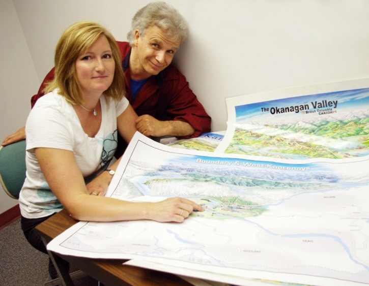
The “3D” image will feature communities in the region, which will be displayed on six 10-by-20-foot billboards, three of which will replace aging signs at Meadow Creek, Rossland Museum and the Nancy Green Junction.
In addition, 300 posters will be printed to further highlight the area.
“It’s the only map of its kind that the whole community is shown in one image,” explained Rheault, who has mapped places across the world for the past 30 years. “When you look at an aerial photo, or a true scale map, you don’t get a true picture of what a place feels like.”
In contrast to a road map, atlas or topographic cartography, pictorial maps depict a given territory from an artistic perspective, enhancing landmarks to give the viewer a more familiar sense.
“People now navigate with GPS and online things so the need for precise maps is not as great as it used to be,” said Rheault. “This is to give a comprehensive view of the whole community so it’s more of a family portrait.”
With help from sales consultant Sandra Barron, Rheault stopped into Trail Thursday to not only snap some real shots of the area but to touch base with local businesses that have the opportunity to be featured on the new prominent highway signs that will be erected next June.
Though Rheault has captured many distinct locations before, he said it is still difficult to live up to residents’ standards.
“The challenge is to make the communities look right to the eyes of the local people,” he said. “Essentially, it’s the local people that can really pick up on the nuances and the details that really reflect an area.”
With limited space for about 80 businesses, Barron is striving to get a real cross section on board and has already filled one-third of the slots.
“I think one of the advantages, in the way that Jean Louis has created this, is it really gives a sense of community for the entire West Kootenay and how close Trail is to Rossland, to Castlegar to Nelson and to the Boundary country,” said Barron. “And I think it will really help tourists to visualize how easy it is to do these little day trips and it might encourage them to stay in our area and explore a little more, instead of just passing through.”
Trail councillor Al Graham agrees that showcasing the close proximity of the communities is appealing to tourists.
“Much the same way that Highway 3 suffers with the fact that there’s the Coquihalla and TransCanada . . . we suffer the same fate when 3B is the lesser known route along this stretch of highway,” said Graham, who is the chair of the Lower Columbia Community Development Team’s tourism committee.
Not only will the signs depict how easy it is to travel in the region, they’ll be a huge benefit to the businesses that buy into plugging their location, he added.
“I find a number of people stop at these things to stretch their legs or have a cigarette or whatever,” he said. “So while they’re out, having those signs in those locations, gives an opportunity to catch the traveling public’s eye.”
To get in while the early bird special is still on, business owners are encouraged to contact Mountain Media prior to July 31.
Barron, who’s looking after the West Kootenay, can be reached at 250-666-0436 or via email at info@mountainmedia.org Those from the Boundary area, can conmtact Ted Morris at 250-442-9855 or at info@mountainmedia.org