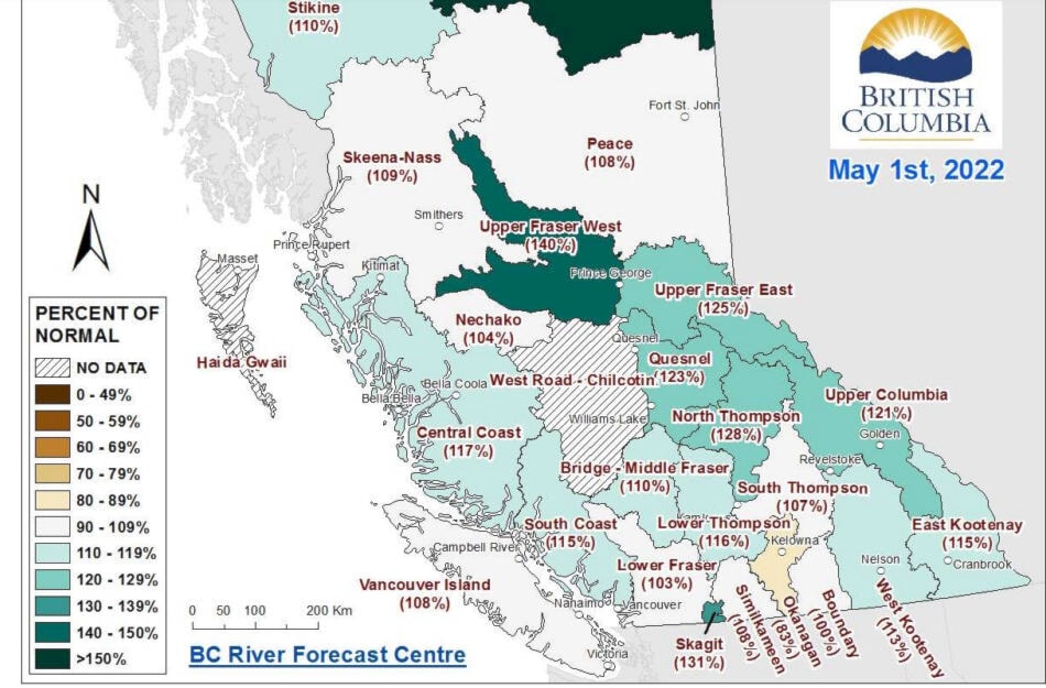
The cool spring we have experienced in the Kootenays means snow packs are not melting at the rate they would in a normal year. The BC River Forecast Centre issued its latest report on May 9, with readings taken from stations around the province on May 1.
The report shows the West Kootenay at 113 per cent of normal and the East Kootenay at 115 per cent. Those numbers could be up a bit more than that as most high elevations received substantial snow over the past weekend, after the latest measurement.
The report says that there are no signs of any significant heat in the short term forecast.
This cool weather can lead to an increased risk of flooding throughout the province, depending on how quickly the snow packs melt when the freshet really picks up, and how much precipitation falls during that time.
“Every region is at risk for flooding, even if the snow pack is below normal. The weather conditions during spring play a critical role in the rate at which the snow melts” the report says. “For example, a gradual warming under dry conditions is ideal to lessen the flood risk. A lengthy cold period with high amounts of precipitation followed by a sudden extreme heat wave could lead to catastrophic conditions, especially if additional rain follows.”
While the Kootenays are not on the current list of areas at high risk for flooding, the report does say that northern parts of the Kootenays have a much higher snow pack than the more southern areas.
READ: B.C. spring flood risk ‘increased considerably’ due to colder than normal weather
READ: Kootenay snow packs drop slightly, still a bit above normal
carolyn.grant@kimberleybulletin.com
Like us on Facebook and follow us on Twitter
