Backroad Mapbooks have created another feature to guide West Kootenay outdoor enthusiasts into the wilderness.
Trail natives and Backroad's founders Russell and Wesley Mussio are celebrating 20 years as Canada's leading outdoor publisher by introducing a new waterproof outdoor recreation map for the West Kootenay.
“We're basically trying to replace the old BC Forest Service recreation maps that were out there and use to be quite popular, so we're working with those guys to help us,” said Russell Mussio.
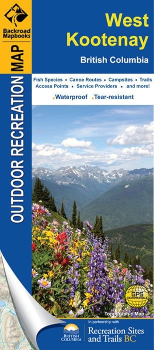
The new map is compact, tear resistant, waterproof, and extra rigid for those variable mountain weather conditions while showcasing a variety of recreational opportunities.
“It's a lot more convenient obvioulsy,” said Mussio. “The Backroad Mapbook is individual page format, while this is a traditional fold up map so you get a lot larger area, and there's also other little features that you don't get on the mapbook like Fish BC and advertisers as well, so if you're new to the area there's a nice little feature so you can kind of figure out who to go to to get supplies.”
The map offers detailed topographic information with up-to-date industry and logging roads, extensive trail systems, and a ton or recreational features not found on other maps.
The map has information for the hiker, kayaker, fisherman, canoeist, ATVer, and more, from the extreme alpinist to the happy camper, the new map is a must for all types of recreationist.
“It's one of the benefits of our product, it's used by everyone from the hardcore person right down to the person who just wants a good map of the West Kootenay.”
The Backroad series requires not only a team of researchers to ensure regional information is accurate and complete, but also cooperation and input from various organizations such as fishing and hunting clubs, park superintendants, hiking enthusiasts, government ministries, in addition to feedback directly from readers.
“We can't thank our partners and local help enough,” said marketing manager Matthew Cosar. “Groups like the Quad Riders ATV Association of BC, BC Parks, and Recreation Sites and Trails BC were instrumental in providing insider details for users. Also we would like to mention Ross Elliot, Tom Lymbery owner of the Gray Creek Store, and Bob Dure for taking the time to help create this map.”
The mapbook was born out of the Mussio brothers own frustration in finding reference guides for the backcountry of the Kootenays. And since it's humble beginning from a printing press in the Mussio brother's living room, the Backroad Mapbook series has expanded dramatically over the last 20 years, and 1.5 million sold copies later, it continues to develop and evolve into a national product.
“We're very happy right now, we've obviously seen a transition from a very paper based obviously the mapbooks down to a lot more of a diversified company where the digital and the GPS maps and all those products are kind of replacing what we feel are the loss in printed products . . . the spinoffs like these recreation maps are nice because it give us a lot more diversification.”
The new mapbook can be purchased at local bookstores and BC Forest offices. Go to Facebook.com/backroadmapbooks and join the 20th anniversary celebration with their Facebook Adventure Contest.